cancel
Showing results for 
Show  only  | Search instead for 
Did you mean: 
  • Image to Table JMP extension imports single or batch images as data tables. Useful to extract curves from pictures or convert image data to curve data to use in analyses like Functional Data Explorer. Download and install the extension.

Discussions

Solve problems, and share tips and tricks with other JMP users.
Choose Language Hide Translation Bar
fishguy
Level III

Map file specific for Chesapeake Bay

I would like to try the geographic map feature with some of my data. Are there any sites or sources with a wider range of maps than what is provided with JMP? Specifically, I would like a map of the Chesapeake Bay. I'm not an Arc user so do not have access to that.


Thanks!

1 REPLY 1
Craige_Hales
Super User

Re: Map file specific for Chesapeake Bay

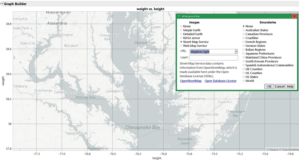
Have you tried the street map service? I know, it seems counter-intuitive for a water feature, but it's pretty detailed around the edge.

If you need more than that, you might find a web map service provider that will give you a url and a layer that makes sense for your data.
Chesapeake BayChesapeake Bay


Craige

Recommended Articles